GK2A Satellite image decoder
a windows walkthrough on decoding GK2A satellite image
In a group project focused on receiving and decoding data from the GK2A satellite, my team of 5 collaborated on various aspects, including receiving antenna design, software-defined radio (SDR) programming, demodulation, decoding, and final image generation.
My specific contribution was to the decoding phase, with reference to a blog series guiding the work. The entire experiment was conducted on a Windows machine, and the detailed procedure for running the program is documented in my repository in simplified Chinese.
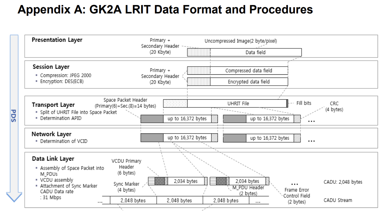
Throughout the project, valuable insights into the GK2A satellite’s LRIT data format and its encoding mechanisms were gained. By reversing the encoding steps, I was able to retrieve unprocessed data streamed directly from the satellite.
For a more comprehensive understanding of the satellite’s data encoding chain, a detailed illustration is here:

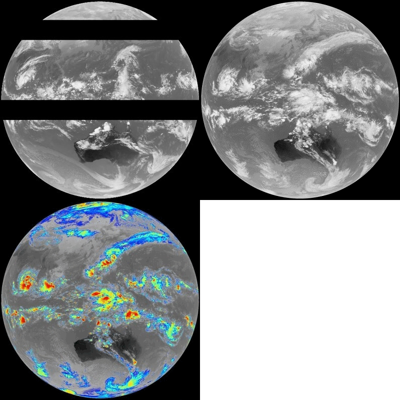
Finally, take a look at some of the images we generated from the signal that traveled a considerable distance to reach us:
